Tainan County (Tainan)
Tainan County was a county in southern Taiwan between 1945 and 2010. The county seat was in Sinying City.
Tainan County was established on 7 January 1946 on the territory of Tainan Prefecture (臺南州) shortly after the end of World War II. In the early years, Tainan County consists of most territory of Tainan Prefecture except the territory near cities of Tainan and Kagi (Chiayi). The county is subdivide into districts (區), which is reformed from Japanese districts (郡). The districts are divided into townships. On 16 August 1950, another division reform was implemented. The northern part of the county was separated and established Chiayi County and Yunlin County. The remaining Tainan County has territory equivalent to the Shin'ei (Hsinying), Niitoyo (Hsinfeng), Shinka (Hsinhua), Sobun (Tsengwen), and Hokumon (Peimen) in the Japanese era. In addition, districts in the remaining part of Kaohsiung County was defunct. All townships were directly controlled by the County Government. On 25 December 2010, the county merged with Tainan City to form a larger single special municipality.
Tainan County was established on 7 January 1946 on the territory of Tainan Prefecture (臺南州) shortly after the end of World War II. In the early years, Tainan County consists of most territory of Tainan Prefecture except the territory near cities of Tainan and Kagi (Chiayi). The county is subdivide into districts (區), which is reformed from Japanese districts (郡). The districts are divided into townships. On 16 August 1950, another division reform was implemented. The northern part of the county was separated and established Chiayi County and Yunlin County. The remaining Tainan County has territory equivalent to the Shin'ei (Hsinying), Niitoyo (Hsinfeng), Shinka (Hsinhua), Sobun (Tsengwen), and Hokumon (Peimen) in the Japanese era. In addition, districts in the remaining part of Kaohsiung County was defunct. All townships were directly controlled by the County Government. On 25 December 2010, the county merged with Tainan City to form a larger single special municipality.
Map - Tainan County (Tainan)
Map
Country - Taiwan
 |
 |
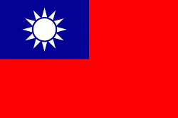
| Flag of Taiwan | |
* in East Asia. It is located at the junction of the East and South China Seas in the northwestern Pacific Ocean, with the People's Republic of China (PRC) to the northwest, Japan to the northeast, and the Philippines to the south. The territories controlled by the ROC consist of 168 islands, with a combined area of 36193 km2. The main island of Taiwan, also known as Formosa, has an area of 35,808 km2, with mountain ranges dominating the eastern two-thirds and plains in the western third, where its highly urbanised population is concentrated. The capital, Taipei, forms along with New Taipei City and Keelung the largest metropolitan area of Taiwan. Other major cities include Taoyuan, Taichung, Tainan, and Kaohsiung. With around 23.9 million inhabitants, Taiwan is among the most densely populated countries in the world.
Currency / Language
| ISO | Currency | Symbol | Significant figures |
|---|---|---|---|
| TWD | New Taiwan dollar | $ | 2 |
| ISO | Language |
|---|---|
| ZH | Chinese language |


